Itineraire
18 – LE GENÉVRIER THURIFÈRE
- Foot
- Trail
Steps
- Step 1
- From the Place des Évadés (altitude 526 m), descend towards the village and take the street on the right (signposted ""sentiers"").
- Step 4
- Climb the steep path called ""la travée de descente des wagonnets"" until you reach the sign (altitude 630 m). Continue straight ahead, climbing this yellow-marked trail. You will come to a fork (altitude 850 m) with a sign for ""Sentier du Thurifère 2h"" on the left and ""Marignac 1h"" on the right.
- Step 5
- Follow the Thurifer's Path and you will find a juniper tree and a beech tree marked with yellow signs.
- Step 2
- You will arrive at the ""Saint-Roch"" signpost (altitude 522 m), turn right. Climb up the stony path that runs alongside a property. You will arrive at a small chapel and a picnic table. Follow the path in front of you to reach the Saint-Martin chapel (signpost – altitude 588 m) and a few houses.
- Step 6
- The path climbs through a rockier, more Mediterranean landscape, offering beautiful views of the valley.
- Step 3
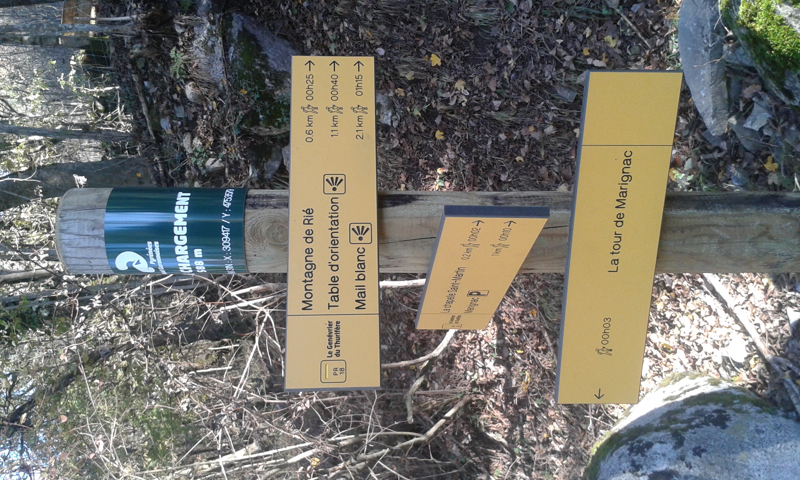
- Turn left and walk past the picnic table to reach the ""Quai de chargement"" signpost (altitude 588 m).
- Step 7
- You will arrive at a fork indicating the marble quarries. Stay on the path clearly marked in yellow. Begin the descent with a steep section.
- Step 8
- You will return to the initial fork (altitude 850 m). Take the path to the left marked ""Marignac – 1 hour"".
- Step 9
- The trail passes through a beech forest. Descend the steps and follow the track downhill.
- Step 10
- At the point marked 692m, take the path downhill on your right (signposted ""Marignac – 30 minutes""). This path is a little steep and descends to the houses of the hamlet of Saint-Martin, just opposite the chapel.
- Step 11
- Take the path downhill towards Marignac, and after 10 minutes you will return to the Place des Évadés.
Itineraire
18 – LE GENÉVRIER THURIFÈRE
Place des Évadés
31440 MARIGNAC
31440 MARIGNAC