Itineraire

LE PIC DU CÉCIRÉ

  • Foot
Pic du Céciré 1
Pic du Céciré 1
Coume de Bourg
Pic du Céciré 2
Vue du Céciré
Modèle Sity trail
Modèle Sity trail

Steps

1 –
Starting from the Superbagnères plateau, follow the GR10 signs towards the crests. Near the Arbesquens ski lift, follow the red and white markings on the GR10, which has recently been redesigned to provide a safer route.
2 –
The well-marked path runs along the grassy ridge overlooking Superbagnères. It alternates between rising false flats and gentle, more sustained climbs. Below, the Lys valley comes into view. After around 1? hours' walking, you reach the Col de la Coume de Bourg (2,240m).
3 –
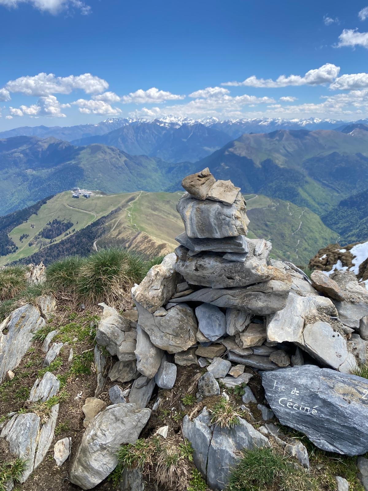
At the pass, leave the GR10 and turn right onto a well-marked path that follows the ridge. This is a panoramic route with no major technical difficulties. You arrive at the summit on an unobstructed rocky platform overlooking the whole of the Luchonnais basin and the great peaks of the border. The return journey takes the same route.
Itineraire
LE PIC DU CÉCIRÉ
Plateau de Superbagnères
31110 SAINT-AVENTIN

New - The Tastes & Flavors Guide

While eating well without breaking the bank is a major concern for our fellow citizens, short supply chains are thriving in Comminges. Now more than ever, there has been a growing need for a guide that lists producers, restaurateurs, and food professionals who sell their creations directly to consumers and work with local products in an ethical manner.

From Farm to Table with Complete Transparency: The Charter

The Charter of Commitment was developed by and for professionals in partnership with the Comminges-Pyrénées Tourism Office. It highlights producers from all fields and chefs who work according to best practices, promote Comminges products, and share their respective expertise.

The guide “Goûts et Saveurs en Comminges” is not just a directory of businesses. It is much more than that. As you turn the pages, you’ll also find recipes, profiles, and interviews.